10 Mile ARC to VOR 30 Approach - Hobart, Tasmania Australia (YMHB)
/Approach chart depicting VOR 30 Approach to YMHB. Important points to note are: initial approach courses to intercept the arc (295 & 334), the D10 HB arc, the altitude increments of 4000, 3000 and at 7 miles, 2400, and the Initial Approach Fix (IAF) and speed of 210 kias
Recently, I flew from Brisbane to Hobart and the pilot flying made a different style of approach to what normally is made at this airport. After landing, I approached the pilots and queried the approach. The Captain stated that he had decided to fly a semi-automated VOR approach along an arc to land at runway 30.
The reason being, that Air Traffic Control (ATC) had warned them of turbulent conditions near the airport. He commented that in such conditions, he felt more confident using the older style arc approach using LNAV/VNAV with Speed Intervention (SPD INTV) engaged, with a transition to Vertical Speed and VOR once on final.
The First Officer stated that this was the first time he had seen an arc being used to set-up for a VOR approach. He said that usually they use ILS into RWY 12 or RNAV into RWY 30. He commented that the only time he had made a VOR approach was during simulator training, and then he would probably only use such an approach, if the ILS was inoperative or there was an issue with RNAV.
The use of this approach is a prime example of the variation offered to pilots in relation to how they fly and land the Boeing 737.
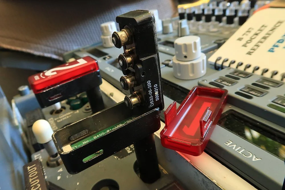
Screen Images
Several screen captures from the Instructor Station, CDU and Navigation Display (ND) which I hope will make it easier to understand this post. The avionics suite used is ProSim737 distributed by ProSim-AR. Note that some of the mages are not sequential as I captured the images over two simulator sessions.
How To Set-Up An Arc
To set-up an approach using an arc is very easy.
The following example is for Hobart, Tasmania Australia (YMHB). The instructions assume that you are conversant with operating the CDU and have a basic understanding of its use.
Essentially, an arc is using a Place/Bearing/Waypoint to define an arc around a point at a set distance. The distance between each of the generated waypoints along the arc, is at the discretion of the flight crew.
Approach Charts
To determine the correct distance to create the arc, the approach chart for the airport should be consulted. The chart, in addition to providing this information, will also aid you in decided where to place the final waypoint (if wanted) along the approach course.
In this example, the YMHB VOR 30 approach states that the aircraft must fly an arc 10 miles from the airport between an altitude of 4000 and 3000 feet before descending to be at 2400 feet 7 miles from the runway threshold.
The approach chart depicted is provided by Lufthansa Systems (LIDO/FMS) distributed by Navigraph.
CDU Instructions
(i) Open the FIX page and type in the scratchpad the airport code (YMHB). After uploading, type the distance (/10 miles). This will create a green-dotted citcle around YMHB with a radius of 10 miles.
(ii) Open the LEGS page and type into the scratchpad the airport code (YMHB). Immediately following YMHB, type the required radial1 (in degrees) from the airport that you wish the initial waypoint to be generated. Follow this with a slash and type in the distance from the airport (YMHB340/10).
This will generate a waypoint 10 miles from YMHB on the 340 radial. This is the waypoint from which you will begin to build your arc.
Obviously, the radial you use to define the location of your first waypoint will depend upon the bearing that you are flying toward the airport.
(iii) To Generate the ARC you must repeat the above process (ii) changing the radial by 10 degrees (or whatever you believe is needed) to generate the required waypoints around the arc at 10 miles from the airport. As an example: YMHB320/10, YMHB340/10, YMHB000/10 and so forth until the arc is built.
As you upload each of the radials you will note that the name for the waypoint is changed to a sequential number specific to each waypoint. As an example; the above waypoints will each be named YMH01, YMH02 and YMH03.
If you make a mistake, you can delete a waypoint and start again; however, realize that the sequential numbers will not be in order. This is not an issue (it is only a number) but it is something be aware of.
In our example, the VOR approach is for runway 30. Therefore; your final waypoint on the arc will be YMHB121/10. Prior to reaching this waypoint, if flying manually, begin the right hand turn to intercept the approach on the 121 radial (bearing 300 degrees).
A Note About /-+
The more observant will note that the distances in the example above do not utilise the /+ key before the distance (YMHB340/+10). When entering the distance it can be with or without the + key.
Variation
Before going further, there are many ways to fly the B737. The method selected is at the discretion of the pilot in command and is dependent upon airline preferences, environmental conditions, and pilot experience. This statement was stressed to me when I spoke with the Captain of the aircraft.
Often an approach will incorporate a number of automated systems including VNAV, LNAV, Vertical Speed, Level Change, VOR Localizer and old fashioned manual VFR flying. In most cases the particular approach will be programmed into the CDU, at the very least for situational awareness. However, the CDU does not have to be used and often a step down approach is a good way to maintain flying skills and airmanship.
Handy Hints
The following hints will assist with situational awareness and in allowing the aircraft to be guided by the autopilot to a point to which manual flight can commence.
If you carefully study the approach chart for YMHB VOR 30, you will note that the altitude the aircraft should be at when at 7 miles from the threshold should be 2000 feet. The chart also depicts the letter D at this point meaning that a continuous descent can be made this point.
Hint One - visual descent point (VDP)
To make the transition from the arc to the approach easier, create a waypoint at the 7 mile point from the airport along the radial used for the approach (YMHB121/7). Using a waypoint allows the aircraft’s Lateral Navigation (LNAV) to be used. This type of waypoint is usually referred to as a Visual Descent Point (VDP).
When the waypoint at 7 miles from the threshold is reached, a transition to manual flying can commence, or Vertical Speed can be used to maintain a 3 degree glidepath (GP) while following the VOR. Remember to change the EFIS from MAP to VOR so you can use the VOR indicator during the approach.
Hint Two - extend runway line
Assuming you have not inserted an approach into the CDU, an aid to increase situational awareness is to select the correct runway from the CDU and enter a distance that the runway line is to be extended from the threshold.
To do this, select runway 30 from the ARRIVALS (ARR) page in the CDU (RWY30) and type the numeral 7 (or whatever distance you require) into the scratchpad and upload. This will extend the green line from the runway threshold to the previously generated waypoint at 7 miles. Ensure you clean up any discontinuity (if observed) in the LEGS page.
This enables three things:
The generation of a 3 degree glidepath (GP) from the distance entered (example is 7 miles) to the runway threshold.
It enables LNAV (even if the autopilot is not engaged) to continue to provide the Flight Director (FD) with heading information during the approach, and
It enables the Navigation Performance Scales (NPL) on the Pilots Flight Display (PFD) to provide glidepath (GP) guidance (assuming that the correct runway or approach is selected in the CDU and NPL is enabled within the ProSim737 avionics suite).
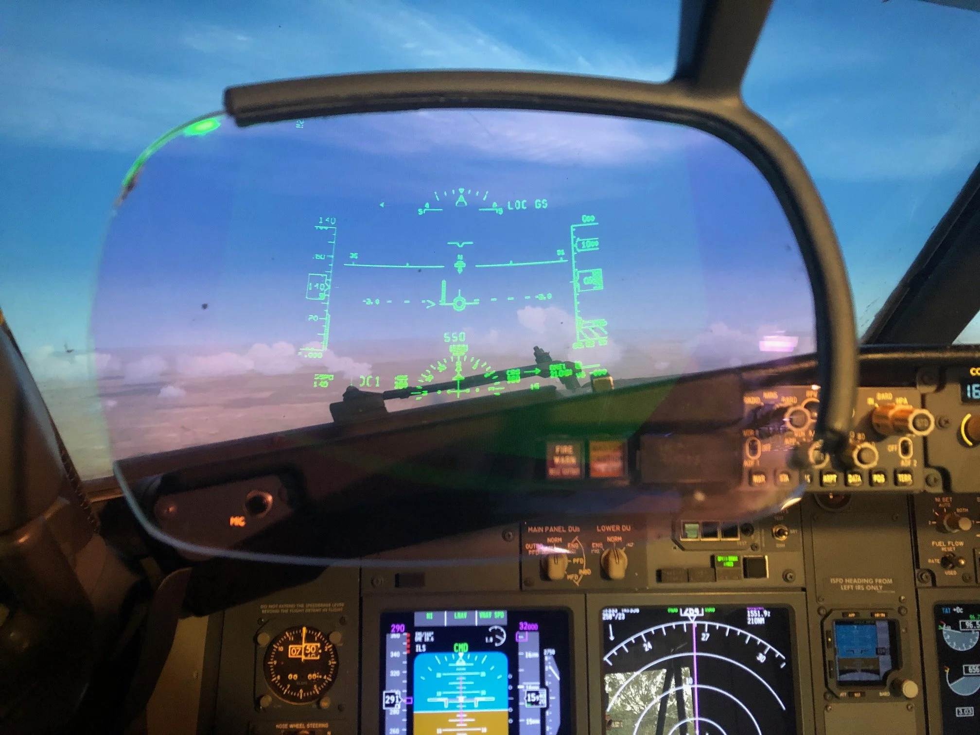
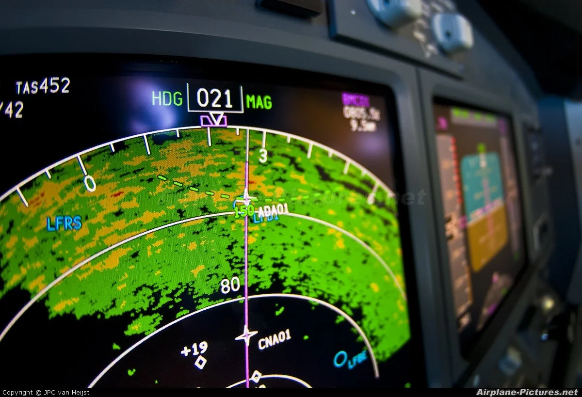
UPPER LEFT: Screen capture from the instructor station PFD and ND for the approach into YMHB. The aircraft, after turning right from the 10 mile arc, is aligned with the 121 radial approaching the waypoint YMH07 (the WP entered at the 7 mile point). LNAV is engaged and the aircraft is being controlled by the autopilot. As RWY 30 was inserted into the route, the Navigation Performance Scales (NPS) show Glidepath (GP) data in the Primary Flight Display (PFD). Note that the EFIS is still on MAP and is yet to be turned to VOR. In real life, VOR would have been selected earlier (click to enlarge).
LOWER LEFT: The transition from LNAV to VOR has occurred and the autopilot and autothrottle are not controlling the aircraft. The aircraft is on short final with gear down, flaps 30 and the airspeed is slowly decaying to VREF+5.
The EFIS has been changed from MAP to VOR to allow manual tracking using the VOR needle. The NPS show good vertical alignment with a lateral left offset; the VOR indicator confirms this. The Flight Mode Annunciator (FMA) displays LNAV (although the autopilot is disengaged) and the Flight Director (FD) and NPS show glidepath (GP) data. The Flight Path Vector (FPV) symbol shows a continuous descent at roughly 3 degrees. The altitude window and heading on the MCP has been set to the appropriate missed approach (4200/300). Click image to enlarge.
Do Not Alter Constraints
As alluded earlier, there are many ways to accomplish the same task. However, DO NOT alter any constraints indicated in the CDU if an approach is selected and executed. CDU generated approaches have been standardised for a reason.
Finding the Correct Radial/Bearing to Build Your Arc
Finding the correct bearing to use on the arc can be challenging for those less mathematically inclined. An easy method is to use one of the two MCP course selector knobs.
Rotate the knob until the green dotted line on he Navigation Display (ND) lies over the area of the arc that you wish the waypoint to be created. Consult the MCP course selector window - this is the figure you place in the CDU. Next, rotate the knob a set number of degrees and repeat the process. You can also consult the data displayed along the course indicator line on the Navigation Display (ND).
When you build the arc, ensure you have set the EFIS to PLN (plan). PLN provides more real estate to visualize the approach on the Navigation Display (ND). You can use STEP in the LEGS page to cycle through the waypoints to ensure you have an appropriate view of the surrounding area.
Important Points
Always double check the Place/Bearing/Waypoint entries in the CDU and in the ND (PLN) before executing. It is amazing how easy discrepancies can occur.
Always check the approach plate for the approach type you are intending to make. Once again, mistakes are easy to make.
If using VNAV, double check all speed and altitude constraints to ensure compliance with the approach chart and situation (some airlines promote the use of the speed intervention button (SPD INTV) to ensure that appropriate speeds are maintained).
If need be, select the approach (ARR) in the CDU to provide added situational awareness.
Images
The following are screen captures from the instructor station CDU and Navigation Display (ND). Ignore altitude and speed constraints as these were not set-up for the example. Click each images to enlarge.
LEFT: Circular FIX ring has been generated around YMHB at 10 mile point. The arc waypoints will be constructed along this line.
LEFT: Various waypoints have been generated along the 10 mile fix line creating an arc. The arc ends at the intersection with the 212 radial for the VOR 30 approach into YMHB. The route is in plan (PLN) view and is yet to be executed.
LEFT: The constructed arc as seen in MAP view. From this view it is easy to establish that the aircraft is approaching TTR and once reaching the 10 mile limit defined by the 10 mile FIX (green-coloured dotted circle), the aircraft will turn to the left to follow the arc waypoints until it intersects with the 121 radial.
LEFT: This image depicts the waypoint generated at 7 mile from the threshold (YMHB121/7). This waypoint marks the point at which the aircraft should be on the 121 radial to VOR 30 and at 2400 feet altitude (according to the VOR 30 approach plate.
LEFT: RWY 30 has been selected from the arrivals (ARR) page. This displays the guidepath (GP) assistance. it also generates a runway line extending from the threshold to 7 miles out; the same distance out from the threshold that the final waypoint was generated.
The course line is coloured pink indicating that LNAV is enabled and the aircraft is following the programmed route.
At the final waypoint (YM10) the autopilot (if used) will be disengaged and the aircraft will be flown manually to the runways using the VOR approach instrumentation and visual flight rules (VFR). The EFIS will be changed from MAP to VOR. LNAV will remain engaged on the MCP to ensure that the NPL indications are shown on the PFD. The NDL indicators provide glidepath (GP) guidance that is otherwise lacking on a VOR approach.
Final Call
I rarely use automated systems during landing, unless environmental conditions otherwise dictate. I prefer to hand fly the aircraft where possible during the approach phase, and often disengage the autopilot at 5000 feet. If flying a STAR and when VNAV/LNAV is used, I always disengage the autopilot no later than 1500 feet. This enables a safe envelope in which to transition from automated flight to manual flight.
Using an arc to fly a VOR approach is enjoyable, with the added advantage that it provides a good refresher for using the Place/Bearing/Waypoint functionality of the CDU.
Additional articles that address similar subjects are:
Glossary
CDU – Control Display Unit (aka Flight Management Computer (FMC).
EFIS – Electronic Flight Instrument System.
LNAV – Lateral navigation.
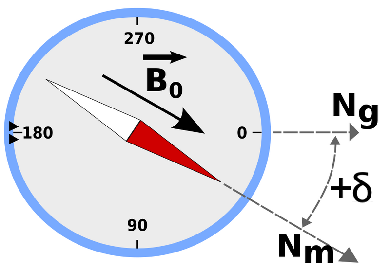
RADIAL/BEARING – A radial radiates FROM a point such as a VOR, whilst a bearing is the bearing in degrees TO a point. The bearing is the direction that the nose of the aircraft is pointing.
VNAV – Vertical Navigation.