Vertical Bearing Indicator (VBI) - How To Calculate A Controlled Idle Descent
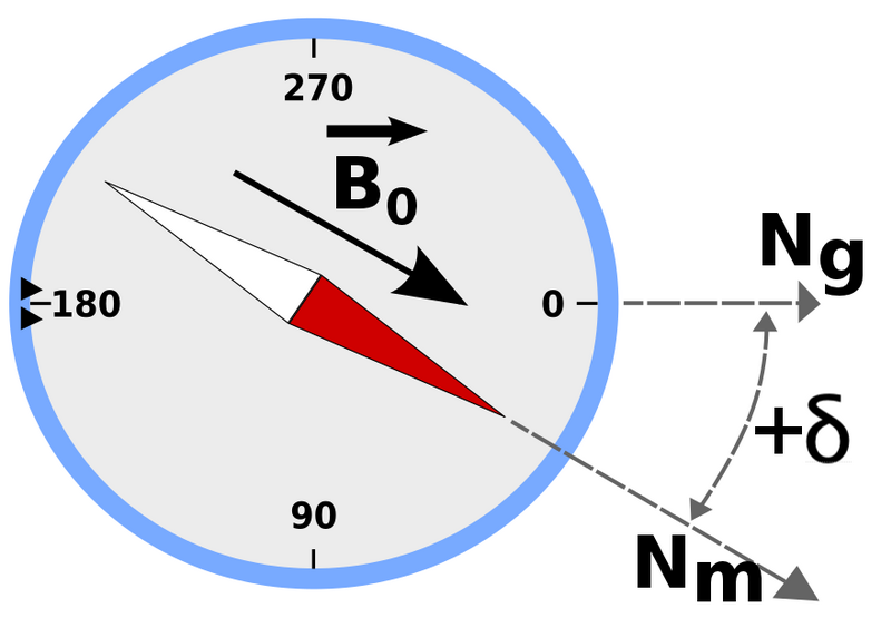
/vertical bearing indicator (vbi) displayed on reproduction cdu manufactured by flight deck solutions (fds)
Air Traffic Control (ATC) often request a change in altitude or ask that you intercept a specific radial during approach or intercept a desired point at a certain altitude for operational reasons. There are several options available that enable you to carry out these requests and change altitude. I have briefly touched on three.
Before continuing, flight simulation avionics packages can differ; often these differences reflect on the flight management software used (U number), however, sometimes the software has not been modeled correctly. The information in this article reflects the real avionics suite used in the 737.
Level Change or Vertical Speed (LVL CHG & V/S): Both are selected from the Mode Control Panel (MCP). Dialing into the MCP a higher or lower altitude and selected LVL CHG or V/S will display on the Navigation Display (ND) an advancing and contracting green line arc (Altitude Range Arc). The green arc identifies, in relation to the active waypoint, the location that the aircraft will reach of the current vertical descent is continued.
Basic Mathematics: Calculation of the distance, vertical speed required and vertical descent can be done using mathematics, but this can be cumbersome and may illicit possible mistakes.
CDU Change: The LEGS page in the CDU can be altered to reflect either a new waypoint or altitude constraints.
However, what if the waypoint is not in the route, or a point in space needs to be created elsewhere along the route and then used as the end of descent point. Is there an easier way, outside of mathematics, to calculate the best flight path angle and vertical speed to these new points.
Vertical Bearing Indicator (VBI)
The Vertical Bearing Indicator (VBI) can help you. The VBI, located in the descent page in the CDU, is basically an angle calculator that provides ‘live’ vertical speed information based upon a desired descent angle. The VBI can simulate any waypoint, runway or other navigation fix uploaded to the calculator. Information can either be downloaded to the scratch pad in the CDU (from the route) and then uploaded to the VBI, or a new waypoint, distance from waypoint, required runway (RWxx) or other navigation fix can be created in the FIX page in the CDU, and then downloaded to the scratchpad and uploaded to the VBI.
The VBI provides 3 fields:
FPA (Flight Plan Angle) is the vertical path in degrees that the aircraft is currently flying.
V/B (Vertical Bearing) is the vertical path in degrees that the aircraft SHOULD be flying to reach the imported waypoint at the desired altitude.
V/S (Vertical Speed) is the vertical bearing (V/B) converted into vertical speed for easy input into the V/S window in the MCP.
The VBI can be used in a number of scenarios and, once its fullest potential is understood, can be used along with the FIX function in the CDU to create additional waypoints and interception points from which descent data can be obtained. Possible scenarios that the VBI can be used are in a:
Approach from downwind;
Approach from base;
Straight-in approach;
Circling Approach;
Arc approach; and,
Descent from altitude to a waypoint, Initial Approach Fix (IAF) or Final Approach Fix (FAF).
One of the main advantages in using the VBI is that the pilot can instigate an accurate controlled idle descent, following a desired glide path to the desired waypoint.
Important Points:
The information and navigation data that can be displayed by the VBI (both in the CDU and ND) is paramount in enhancing spacial awareness, especially for approaches that are not straight-in.
There are several ways that the VBI can be used. I urge you to experiment.
EXAMPLE (Flight Level Change)
In the below example, ATC have requested a flight change from FL20 to FL170 at TESSI.
Navigate to the Descent page by pressing the DES key.
At lower right hand side of the DES page you will see the following: FPA, V/B, V/S. This is the Vertical Bearing Indicator.
Key RSK3 (right line select 3) and enter the waypoint and altitude (TESSI/17000)
To Use The VBI
Observe the V/B. (The idle descent in a 737 is roughly 3.0 degrees).
Wait until the V/B moves between 2.7 and 3.0 degrees (or whatever descent angle you require).
When the value is reached, dial in the required altitude (FL170) and V/S into the MCP (see note)
Once V/S has been selected, the Altitude Range Arc on the ND will intersect the selected waypoint (TESSI) and the aircraft should fly a perfect idle descent to arrive at TESSI at FL170.
Note: If LVL CHG was used instead of V/S, the data in the VBI would reflect the changes that occur from using this descent mode.
Advantages
Two main advantages of the VBI are:
The pilot can instigate an accurate controlled idle descent, following a desired glide path to a desired waypoint or point in space; and,
The pilot can import into the VBI the landing runway and use the data displayed in the VBI to assist in determine the correct vertical speed from the IAF to the FAF.
To use the VBI to display information to the landing runway, download to the scratch pad the RWxx (from the LEGS page) and upload this information to the VBI. This will display the V/S to the runway threshold at a height of 63 feet Above Ground Level. Another way is to type in the required information directly into the VBI. In this case, type either RWxx/ or type RWxx/-0.5 - as mentioned at the beginning of this article, the avionics U number may dictate which method works. The forward slash (/) auto-populates the altitude associated with the runway with the touchdown zone elevation (TDZE).
I often use the VBI from FL10 to the FAF on approach.
VBI and ProSim737
It has been mentioned that the VBI may function differently between avionics suites (U number) and software manufacturers. At the moment, ProSim737 (as at September 2024 running Version 3.24) does not replicate fully the functionality of the VBI. The WPT/ALT should be able to be overwritten at anytime during a flight. ProSim737 does not do this. Instead, the WPT/ALT can only be overwritten when the Vertical Deviation Scale (VDS) is displayed on the ND. This usually occurs when the aircraft has reached Top of Descent (ToD).
I assume that this shortfall will be rectified in upcoming releases.
Video
The above example is demonstrated in the video.
In the video, TESSI has been selected from the LEGS page and downloaded to the scratchpad. Pressing DES opens the required page where the VBI resides. In the scratchpad, the waypoint and altitude constraint is entered – TESSI/17000 and uploaded to the Vertical Bearing Indicator (right line select 3).
If you watch the indicator you will see the V/B and V/S changing as the aircraft approaches TESSI.
Select the new altitude and indicated vertical speed on the MCP . You will note the FPA begins to change, indicating the new vertical path of the aircraft. The Navigation Display (ND) will then show the Altitude Projection Line moving towards and stopping at TESSI. The aircraft will now descend at the nominated angle of descent until reaching TESSI. Note that the original altitude in the LEGS page does not reflect the new change.
Further Information
To read another article on the Vertical Bearing Indicator.
Updated: 29 August 2025